Seen and Not Seen: Tracing Sand Agency in Singapore
In 2003, Nipah Island disappeared beneath the waves of the Singapore Strait, a stand of palm trees being all that remained to mark what had once been sovereign Indonesian soil. The cause was neither climate change nor a natural disaster. Nipah had been dredged out of existence. The culprit: miners fulfilling Singapore’s tremendous appetite for marine-grade sand, a key component of concrete construction and land-reclamation projects. Over the next few years, after another two dozen islands were consumed in Nipah’s Riau Archipelago. As a consequence, Indonesia banned sand exports to Singapore in 2007, sending shockwaves through the Singaporean construction industry.
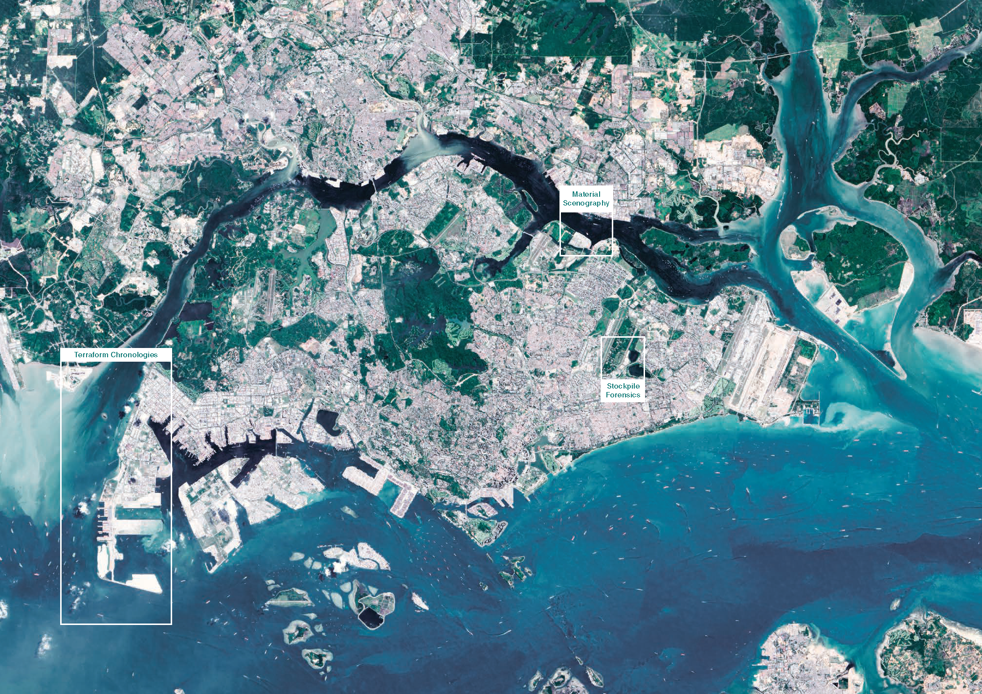
Communicating the ethical implications of the sand trade to both architectural and lay publics requires not only reliable data, but also effective strategies for visualizing that data. This effort is difficult for a multitude of reasons. Singapore uses ocean sand as fill to create infrastructural tracts of land for airports, cargo terminals, and petrochemical processing facilities, in competition against other global logistics hubs. River sand, however, is mixed into concrete for building projects, including high-profile developments like Moshe Safdie’s Marina Bay Sands Casino, or Rem Koolhaas and Ole Scheeren’s “Interlace” condominium. The supply chain for sand is by no means victimless: beyond the local effects of territorial expansion within Singaporean waters, sand mining in Southeast-Asian deltas destroys fisheries and coastlines.
Suppliers and middlemen are lightly regulated and may source material in defiance of local laws or environmental regulations, while land-reclamation projects dump tons of sand onto the seafloor, disrupting local ecosystems. Sand-mining sites are dispersed, small in scale, and often operated by opaque networks of small “front” mining companies for larger national or international industrial suppliers. Such legal subterfuge ensures that even internationally-reported trade figures tend to differ substantially between imports and exports. Singapore’s extreme reliance on the sand trade, by contrast, narrows the list of unknown actors which exist in sand-mining areas, and provides a limited set of sites built with imported sand over a known time period.
Working from Singapore outwards generates critical lenses for analysis, registering sand’s agency in the city’s expanding shoreline, glistening towers, and thrumming industrial hubs. Calibrating the tools of architectural representation to dissect, analyze, and synthesize publicly-available data allows for the production of a new type of drawing set—one that identifies methods of sand delivery, analyzes storage infrastructures, and traces the evolution of the city-state’s coastline—drawing sand-as-agency in Singapore, not only for architects, but for the public as well.
Published in FAKTUR 3, Fall 2020
Research for this article was supported by the Graham Foundation for Advanced Studies in the Fine Arts